


denivell

portefaix
User
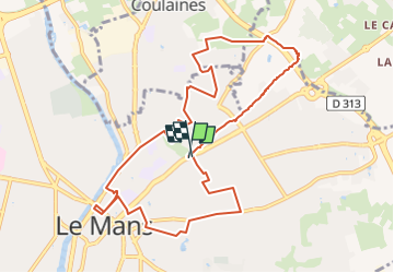

Length
10.6 km

Max alt
106 m

Uphill gradient
196 m
Km-Effort
13.2 km

Min alt
45 m

Downhill gradient
191 m
Boucle
Yes
Creation date :
2022-05-06 06:56:37.711
Updated on :
2022-05-06 06:57:47.005
0m
Difficulty : Very easy

FREE GPS app for hiking
 SityTrail
IGN / Geographical institutes
SityTrail Plus
The world is yours!
About
Trail Running of 10.6 km to be discovered at Pays de la Loire, Sarthe, Le Mans. This trail is proposed by portefaix.
Positioning
Country:
France
Region :
Pays de la Loire
Department/Province :
Sarthe
Municipality :
Le Mans
Location:
Unknown
Start:(Dec)
Start:(UTM)
291951 ; 5321688 (31U) N.
Comments